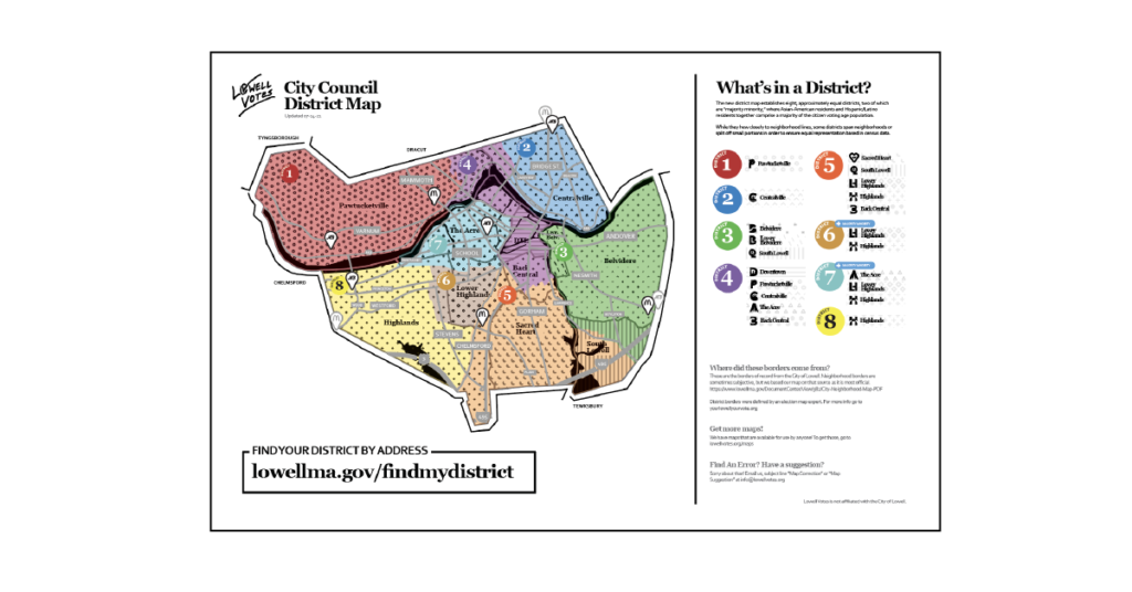
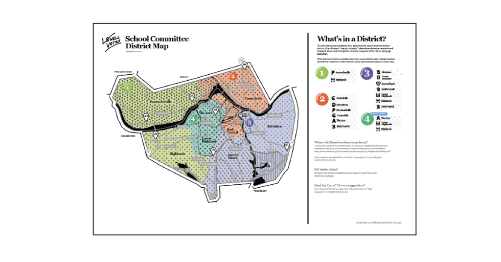
For 2021, we have created a unique twist on the standard-issue district & neighborhood maps!
These maps are meant to help visualize where you are in relation to your polling place. We have included a few well known points of interest to make it even easier for you to orient yourself and find your polling place easier!
City Council Districts
Download the 2021 City Council Map!
School Committee Districts
Download the 2021 School Committee Map!
Map FAQS:
Where did these borders come from?
These are the borders of record from the City of Lowell. Please visit the link below:
- Neighborhoods: https://www.lowellma.gov/DocumentCenter/View/382/City-Neighborhood-Map-PDF
- Districts: http://yourlowellyourvote.org
Can I use this map?
Yes! Lowell Vote’s maps are fair use and can be used by anyone without attribution.
Why do you have Market Basket and McDonald’s on here?
These have been chosen as they are good local wayfinding points that most people would recognize. We have a full local point of interest icon set with some explanations at lowellvotes.org/civicons
Find An Error? Have a suggestion?
Sorry about that! Email us, subject line “Map Correction” or “Map Suggestion” at info at lowellvotes dot org!
What other maps are planned?
When the polling locations are defined, we will add those!
Important Note: All locations indicated are approximate. Lowell Votes is not affiliated with the City of Lowell.


